On real roads
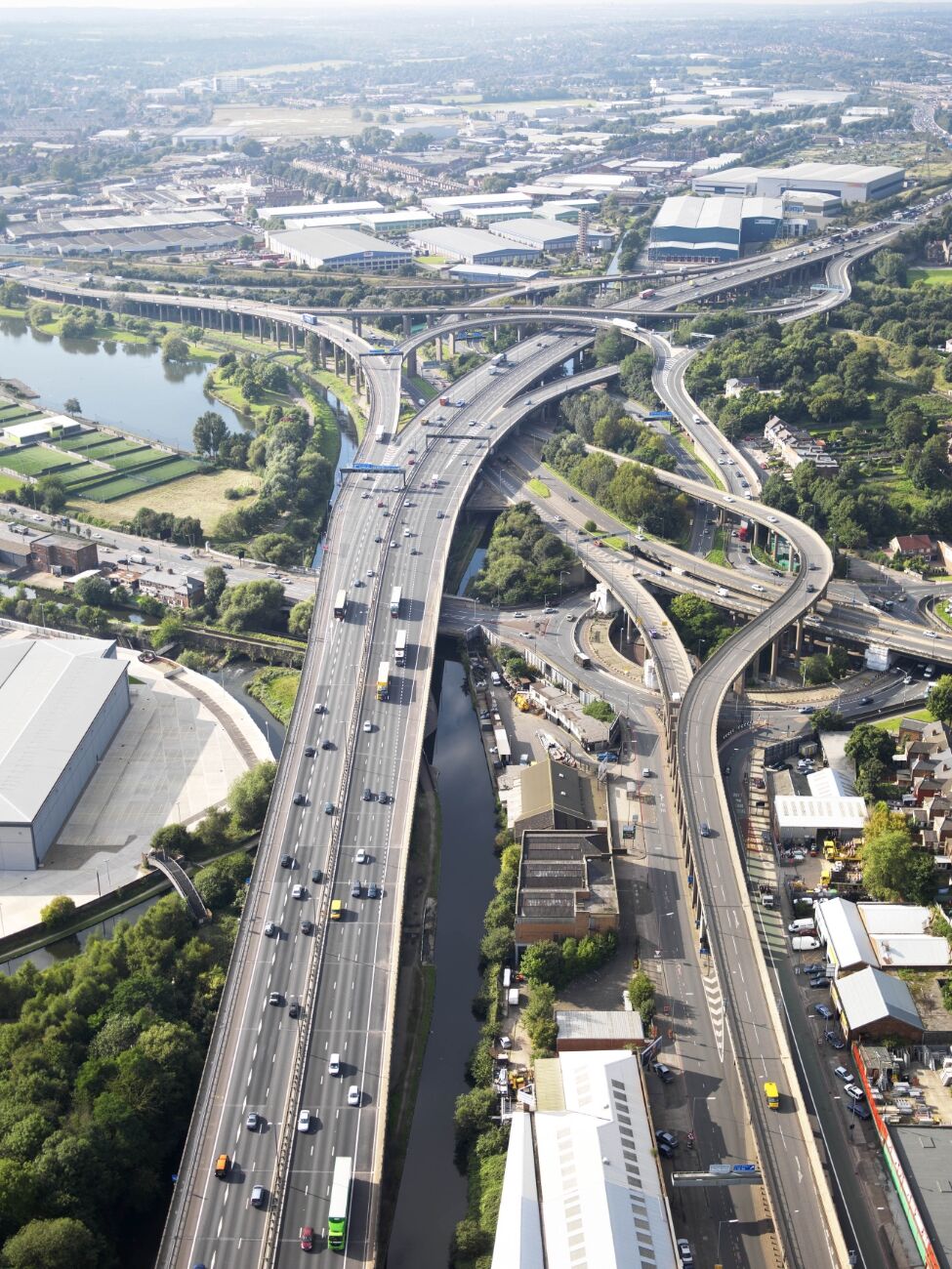
Gravelly Hill Interchange links the M6 with the A38(M) Aston Expressway, A38, A5127 and smaller roads in Birmingham.1,2 Its roads cross at five levels.3 The ramps curve in an uneven pattern around the motorway.4
The interchange was part of the Midland Links project to join the M1, M5 and M6.3 In 1958 the Ministry of Transport asked Sir Owen Williams and Partners to study the missing links. The chosen route passed through the urban area, using corridors over rivers, canals and roads to limit demolition while keeping the motorway close to the places it served. At Gravelly Hill, the M6 had to meet the existing busy junction on the A38 Lichfield Road and the Aston Ring Road.5
In 1965 journalist Roy Smith compared the plans to spaghetti, and subeditor Alan Eaglesfield used Spaghetti Junction in the headline.3 Construction began in 1968, and the interchange opened to traffic on 24 May 1972.1
The Tame Valley Canal passes beneath the motorway at Salford Junction.6 On the approach from the city, the Aston Expressway crosses the River Tame and two railway lines on embankments.2 The slip roads together run for about 2.5 miles (4 km), while the M6 itself extends less than a mile through the structure.7
Where to see one
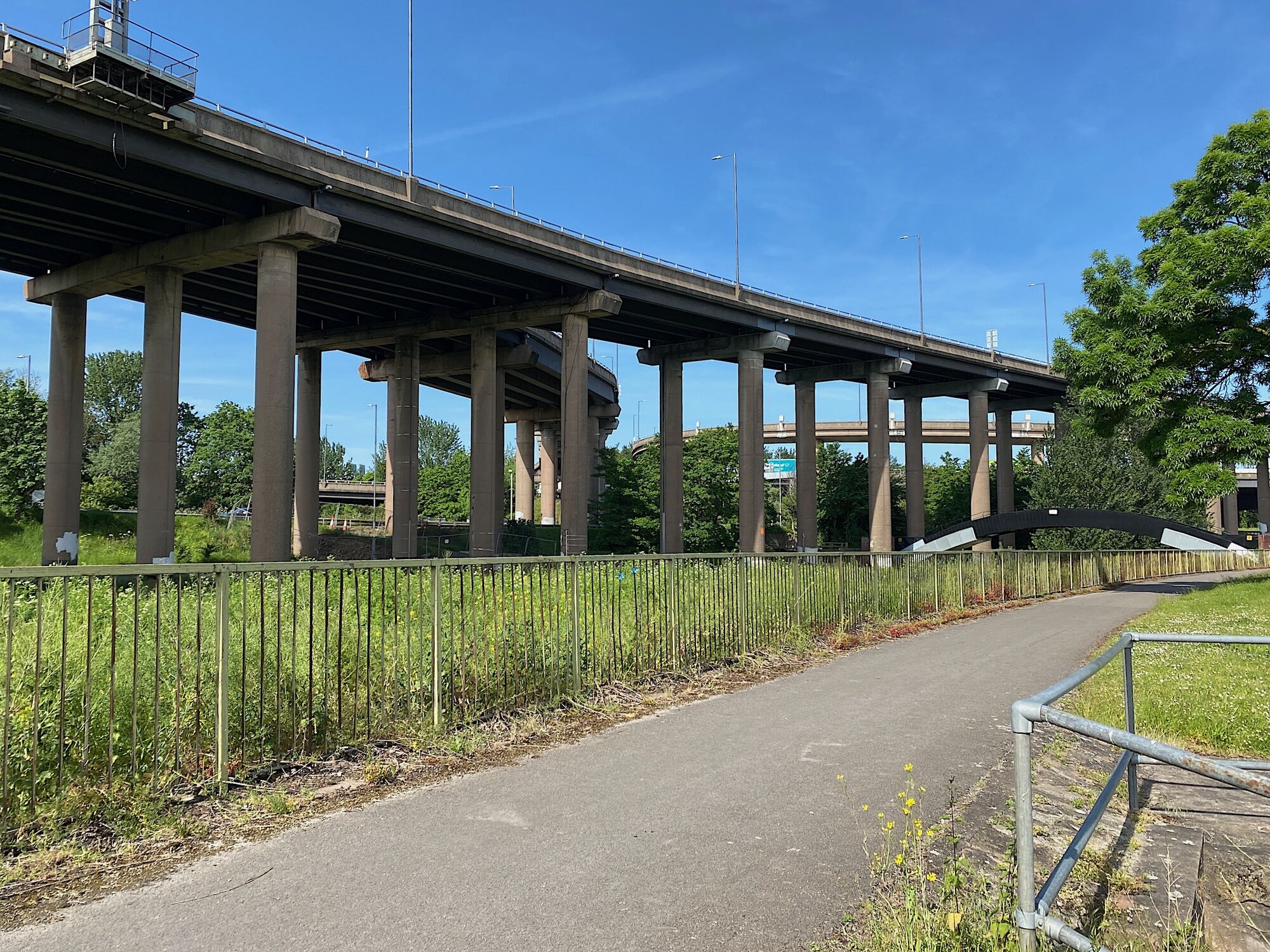
Gravelly Hill Interchange, Birmingham, 2023. Robin Stott, CC BY-SA 2.0, source, cropped, shown in greyscale Gravelly Hill Interchange, M6 junction 6, Birmingham, UK. Map
The Roadform adaptation
In Roadform
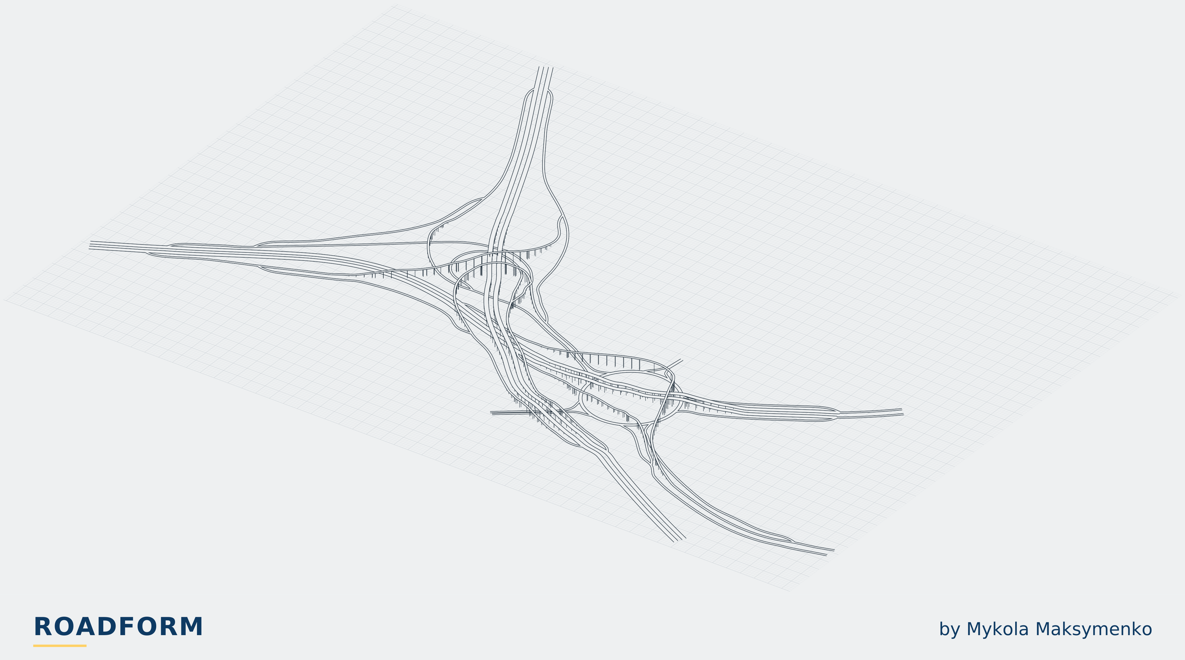
Birmingham's Spaghetti Junction, adapted for TF2. One fixed layout: Left follows the British original; Right mirrors it. Needs a large, fairly flat site.
The long flyovers, the unequal loops and the local roads beneath them make this one fixed landmark. Its road layout occupies about 2.8 by 2 km. Allow more room around the ends to connect your network.
Traffic is the only option. Left follows the British layout and is selected by default; Right mirrors the whole interchange for a map with right-hand traffic. The overview plans use a 100 m grid.
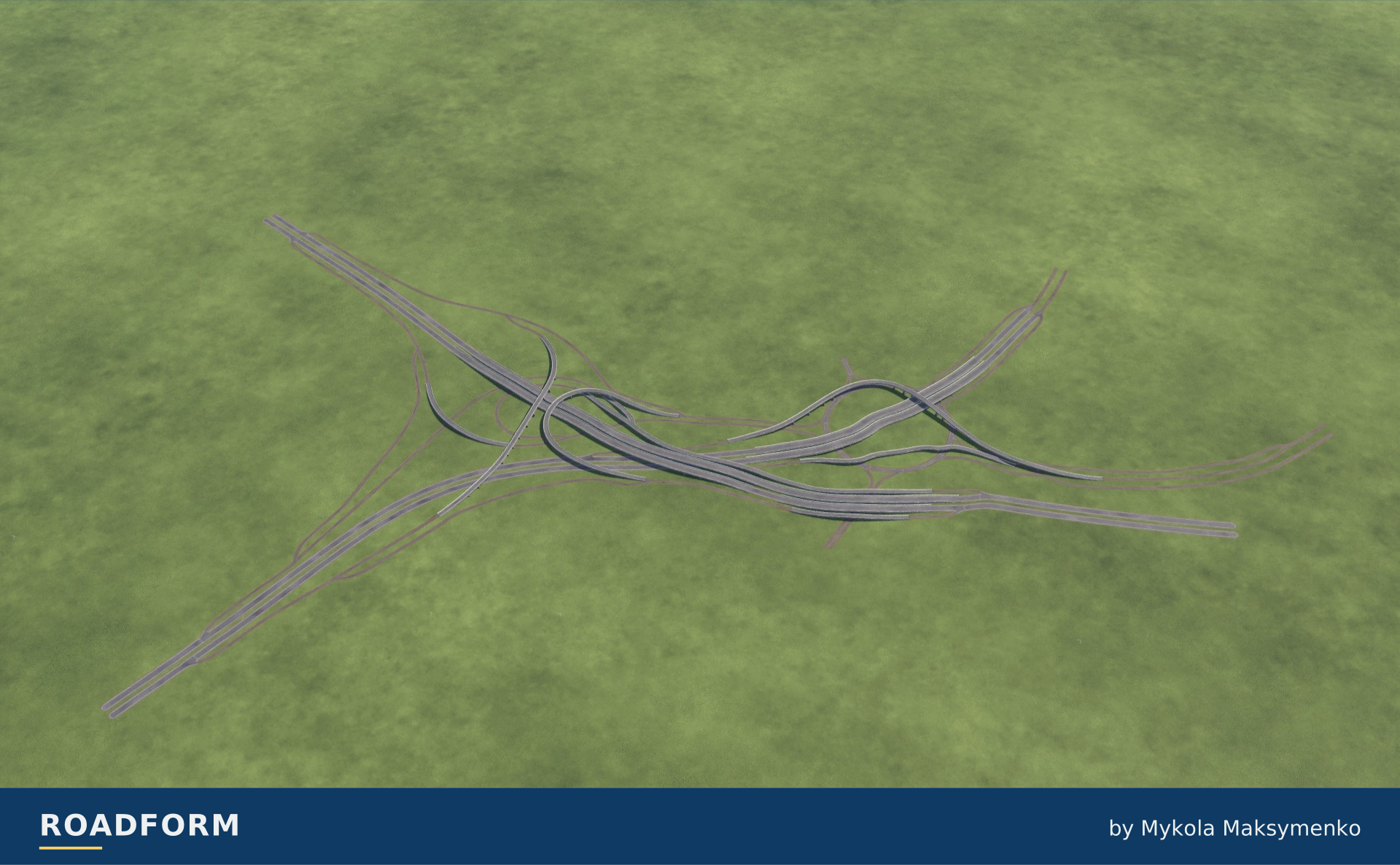
The British layout and its mirror
Left follows the British layout and is selected by default. Right mirrors the interchange. Both plans use a 100 m grid.
TF2 · .
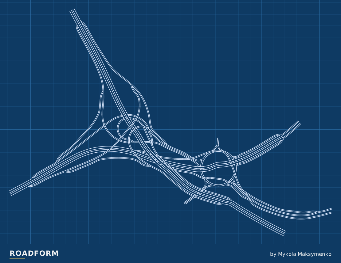
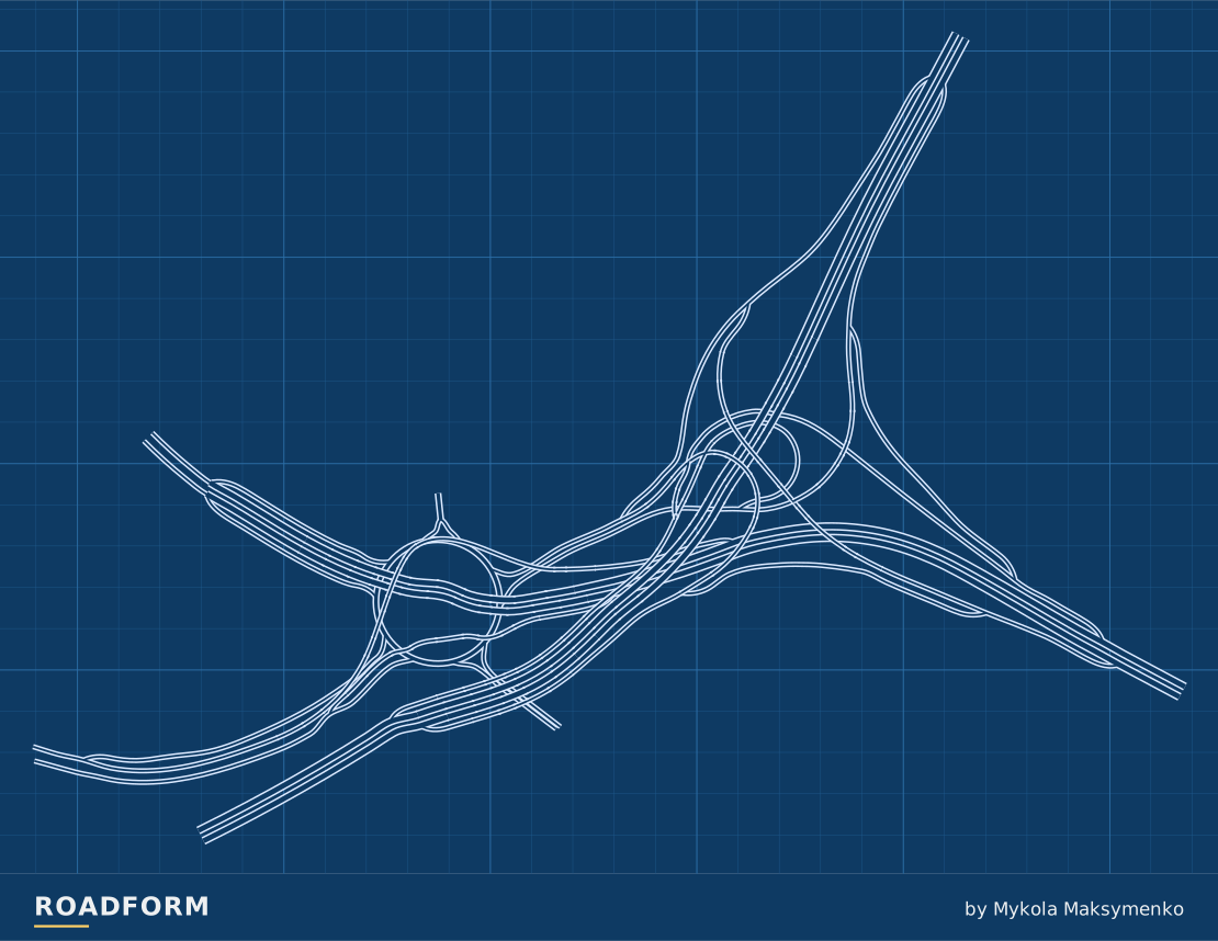
One fixed layout
This design has no size selector. The measurements describe its default layout.
| Layout | Width × depth | Highest road | Lanes per direction |
|---|---|---|---|
| Default | 2790 × 1957 m | 17.5 m | Highway: 3 Cross road: 1 Ramps: 1 Ring: 2 |
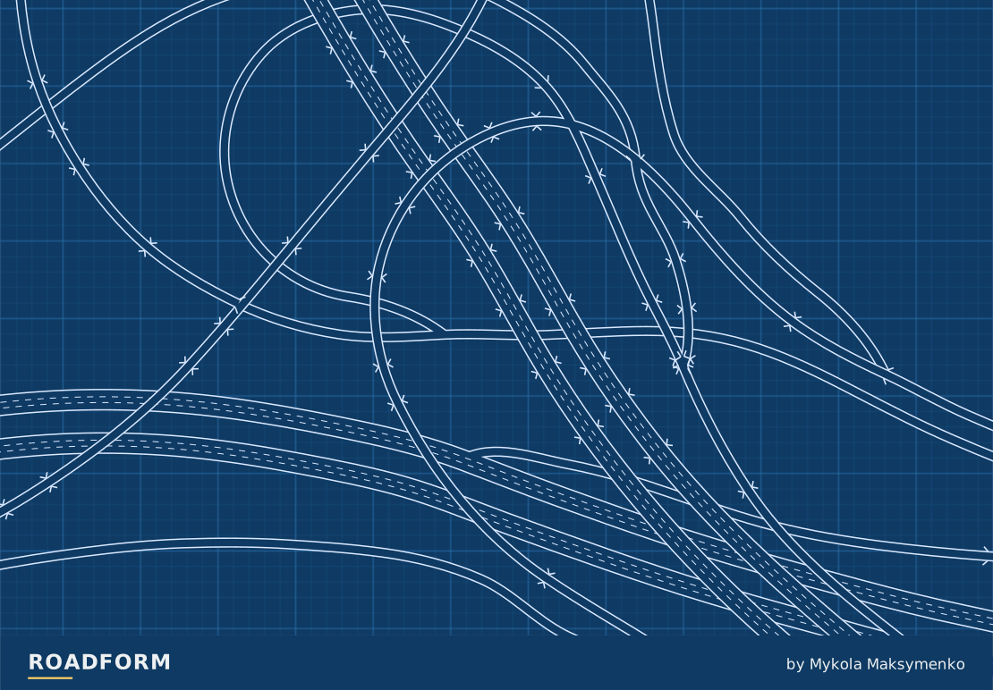
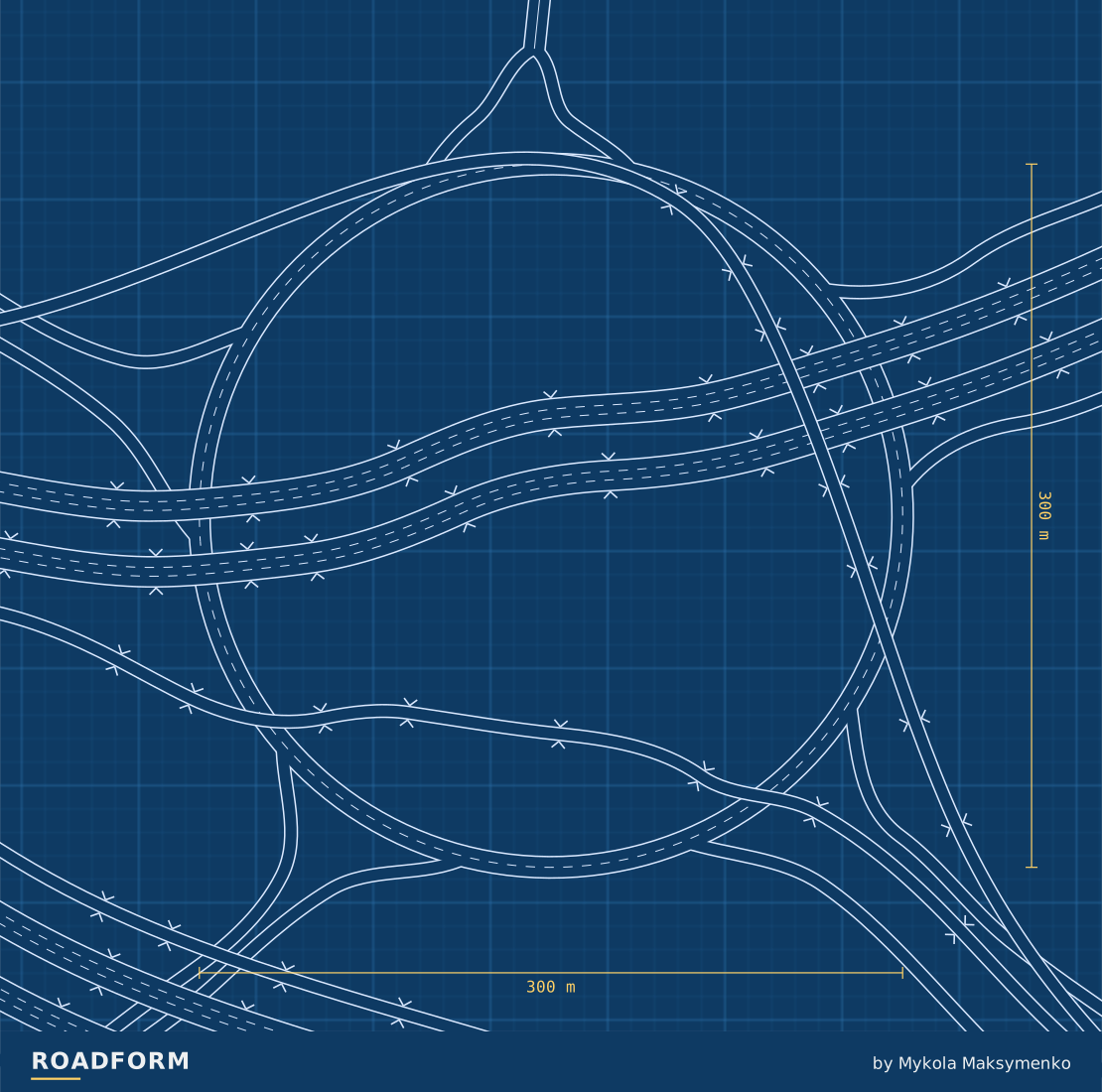
Find Gravelly Hill (Spaghetti Junction) in Roadform's Interchanges category. Choose a large, fairly flat site, select the traffic side and place it. Connect ordinary roads to the open ends.
Both traffic layouts have been built and driven in TF2, with all 13 road ends connected. Keep the supplied road widths through the centre; connect or reshape the approaches outside it.
Sources and credits
- Spaghetti Junction hits 40, Chartered Institution of Highways & Transportation, 2012. www.ciht.org.uk
- A38(M) Aston Expressway, CIHT UK Motorway Archive. ukmotorwayarchive.ciht.org.uk
- Spaghetti Junction (Birmingham) / Gravelly Hill Interchange, Institution of Civil Engineers. ice.org.uk
- Aerial view of M6/A38 Spaghetti Junction, Highways Agency, via Wikimedia Commons, 2008. commons.wikimedia.org
- Midland Links Motorways. M5 (J1 to J3) and M6 (J13 to J1), CIHT UK Motorway Archive. ukmotorwayarchive.ciht.org.uk
- Tame Valley Canal, Canal & River Trust. canalrivertrust.org.uk
- Iconic Spaghetti Junction turns 50 and shows how to pasta test of time, National Highways, 2022. www.gov.uk
Real-world photo credits accompany each image. Roadform figures and measurements use Transport Fever 2.