On real roads
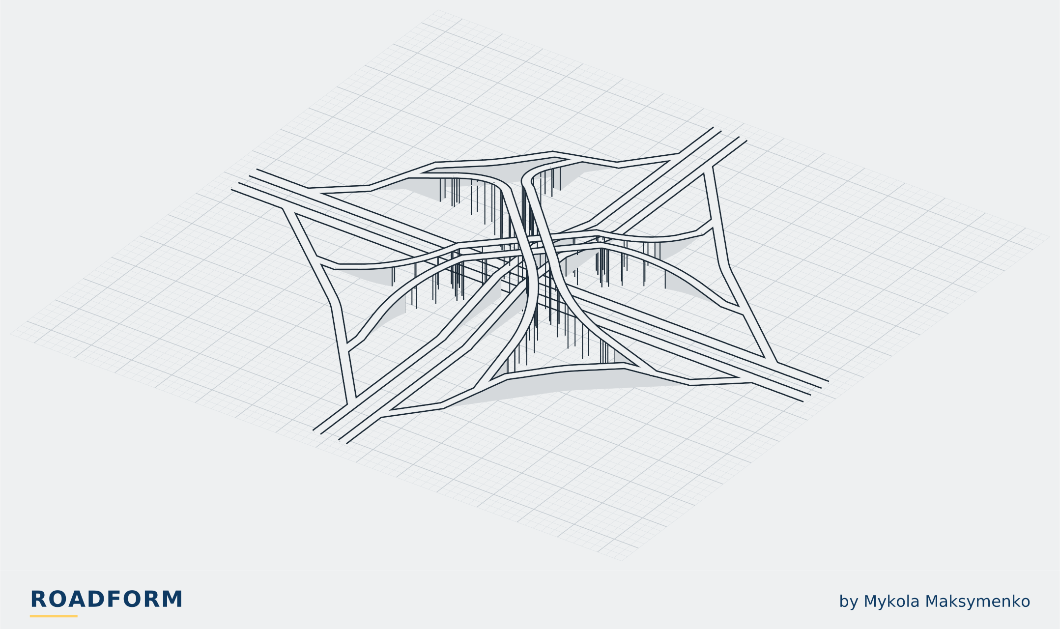
A four-level stack joins two freeways with a direct ramp for every turn, and no loops.1,2 The two freeways cross at the centre, and the left-turn ramps pass the same point on two more levels, so four levels of roadway pass one another at one point.2,3 In Los Angeles they did so in a single bridge structure.3 It is also called a stack or a four-level interchange, and is one kind of fully directional interchange.1,2,4
It began in Los Angeles, where the Hollywood Parkway was to cross the Arroyo Seco-Harbor Parkway at the edge of the Civic Center.3 In 1944 engineers of the California Division of Highways described the four-level grade separation they had developed for that site as an entirely new type of interchange; it grew from an idea first suggested by W. H. Irish, the district location engineer.3 In place of the cloverleaf's 270-degree loop to the right, it gave every movement a simple turn, and the Division's magazine expected it to have more capacity than a cloverleaf.3,5 The structure was completed in 1949, the first of its kind.5,6 On 22 September 1953 all its levels and connecting roads were put into operation for the first time.7
It was offered as a design for other sites too: compact, efficient and safe, and at comparable cost where conditions justified it.3 Early in 1953 it was, so far as was known, the only four-level structure built.8 In the 1940s and into the mid-1950s, Los Angeles began its freeway system with all-directional interchanges between freeways, and Leisch and Morrall write that the form, first developed there, is often called the California 4-Level Stack.2 TxDOT's manual gives it as the four-level directional interchange; carrying the frontage roads through it as well makes a five-level one.1 An FHWA report of 2018 says the northeast junction of I-85 and I-285 in Atlanta typifies four-level interchange design.9
TxDOT's manual says fully directional interchanges are usually justified where two freeways cross.1 Directional interchanges in general are most often built in cities and suburbs; in the country there is generally too little traffic to justify direct or semi-direct ramps in every quadrant.10 The stack's ramps keep close to the way each driver is going: trips are shorter, speeds and capacity higher, weaving is reduced or removed, and there is no loop in which drivers lose their sense of direction.1,11,12 On land the manuals differ: INDOT says directional or semi-directional interchanges may need less right of way than a cloverleaf; MoDOT, that directional interchanges need a large area, though comparatively little more than a cloverleaf.12,13 It gives the highest capacity possible, but its levels of structure make it extremely costly to build, and California's manual asks for its benefits to be fully substantiated.4,11,12 In 1950 the Los Angeles interchange, with its land and the twelve 'satellite' bridges it needed nearby, represented an investment of $5,000,000; Cressy, an assistant district engineer, wrote that an interchange so costly was justified only where large volumes of traffic must be given an easy interchange between freeways.14
In Germany, a 1977 study compared cloverleafs with interchanges with direct ramps, which it called Maltese crosses (Malteserkreuze). These cost about 50 % more to build but gave only a little more capacity overall, as their right turns fared worse than their left.15 Small design improvements to cloverleafs, for only about 5 % more cost, could raise their capacity by up to about 50 %, and the study judged that cloverleafs would as a rule still be enough to join autobahns.15
- Levels
- 4
- Turns
- all on directional ramps12
- First
- Los Angeles, completed in 19496
- Height of the first
- 65 ft (20 m), in reinforced concrete6
- Ramp capacity
- approximately 1,200 to 1,500 vehicles an hour per lane on a direct ramp; an expected design capacity of 800 to 1,200 on a one-lane loop10
- Direct-ramp interchanges against a cloverleaf (Germany, 1977)
- about 50 % more to build, only a little more capacity15
- Usually justified
- where two freeways cross1
- Limit
- costly to build: more and longer ramps, more bridge crossings13
Where to see one
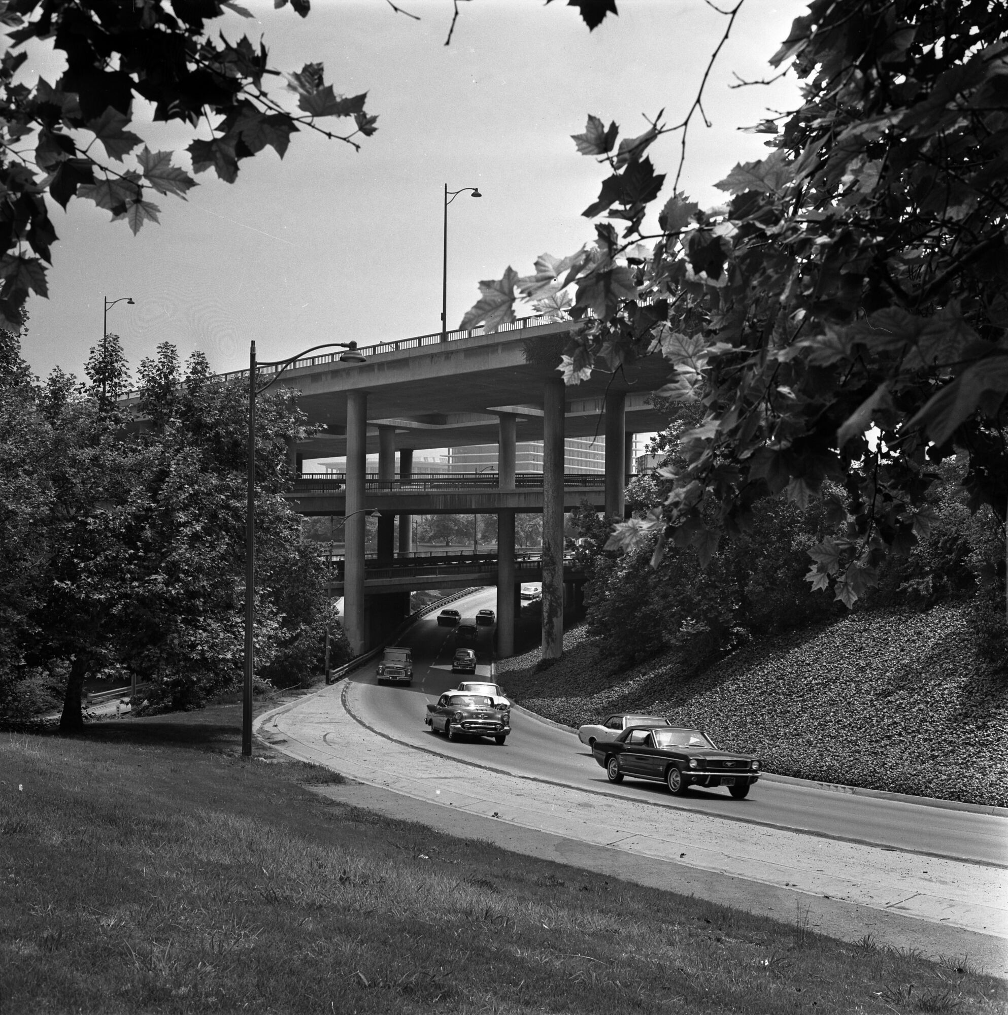
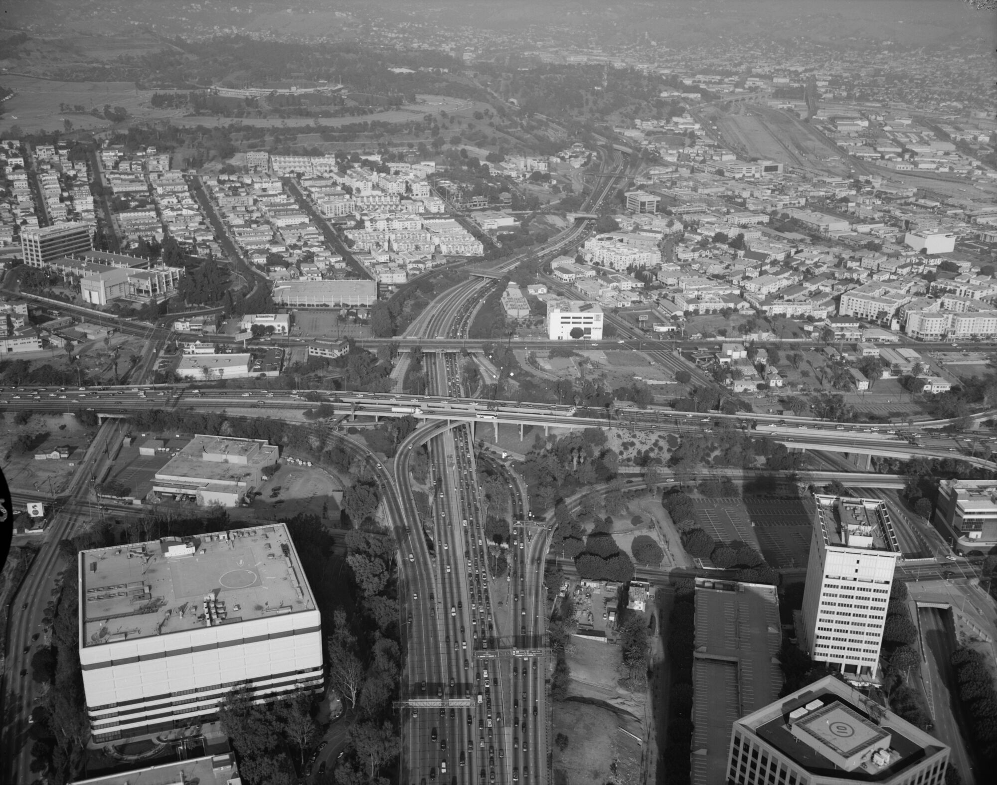
Autos moving from the Harbor Freeway to the Hollywood Freeway on the Four Level Interchange in downtown Los Angeles, 1966. John Malmin, Los Angeles Times, CC BY 4.0, source, cropped, shown in greyscale Four-Level Interchange, Los Angeles, California, US. Map
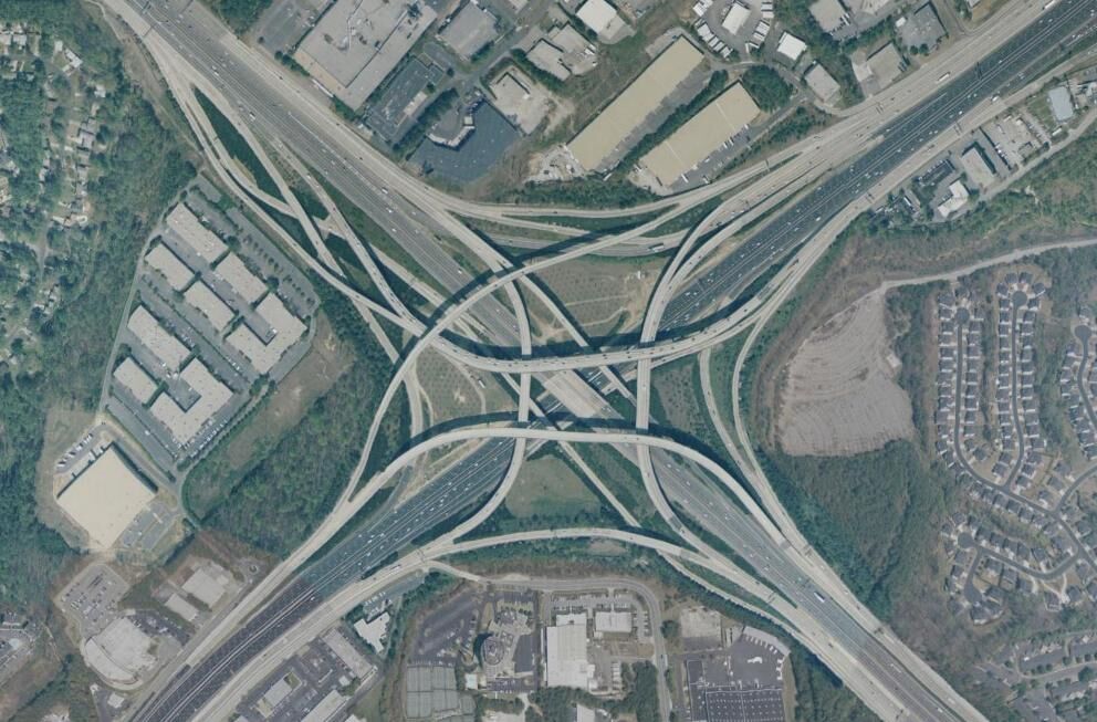
The Tom Moreland Interchange, also called Spaghetti Junction, where Interstate 85 meets Interstate 285 just northeast of Atlanta, Georgia, from the air. United States Geological Survey, PD-USGov, source I-85 at I-285, Northeast Junction, Atlanta, Georgia, US. Map
The Roadform adaptation
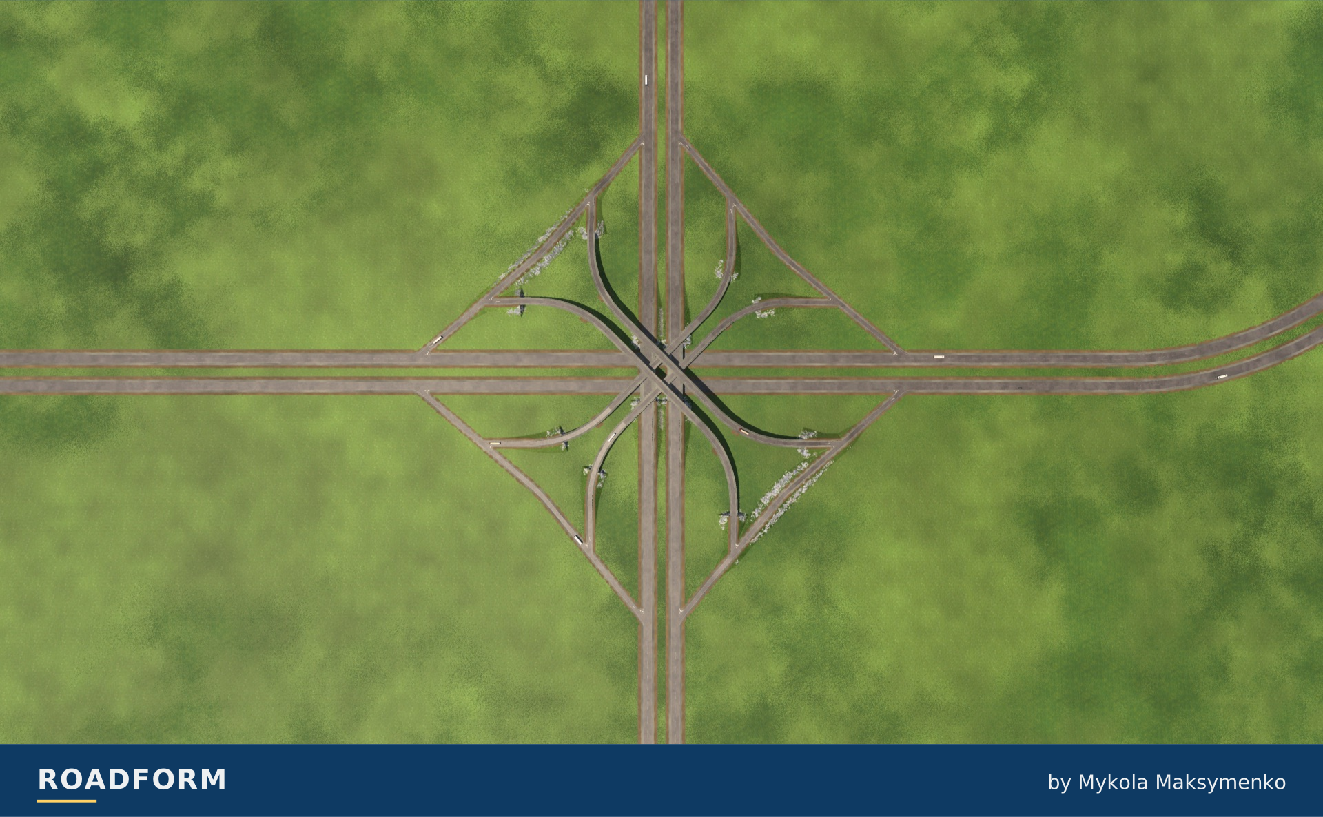
In Roadform
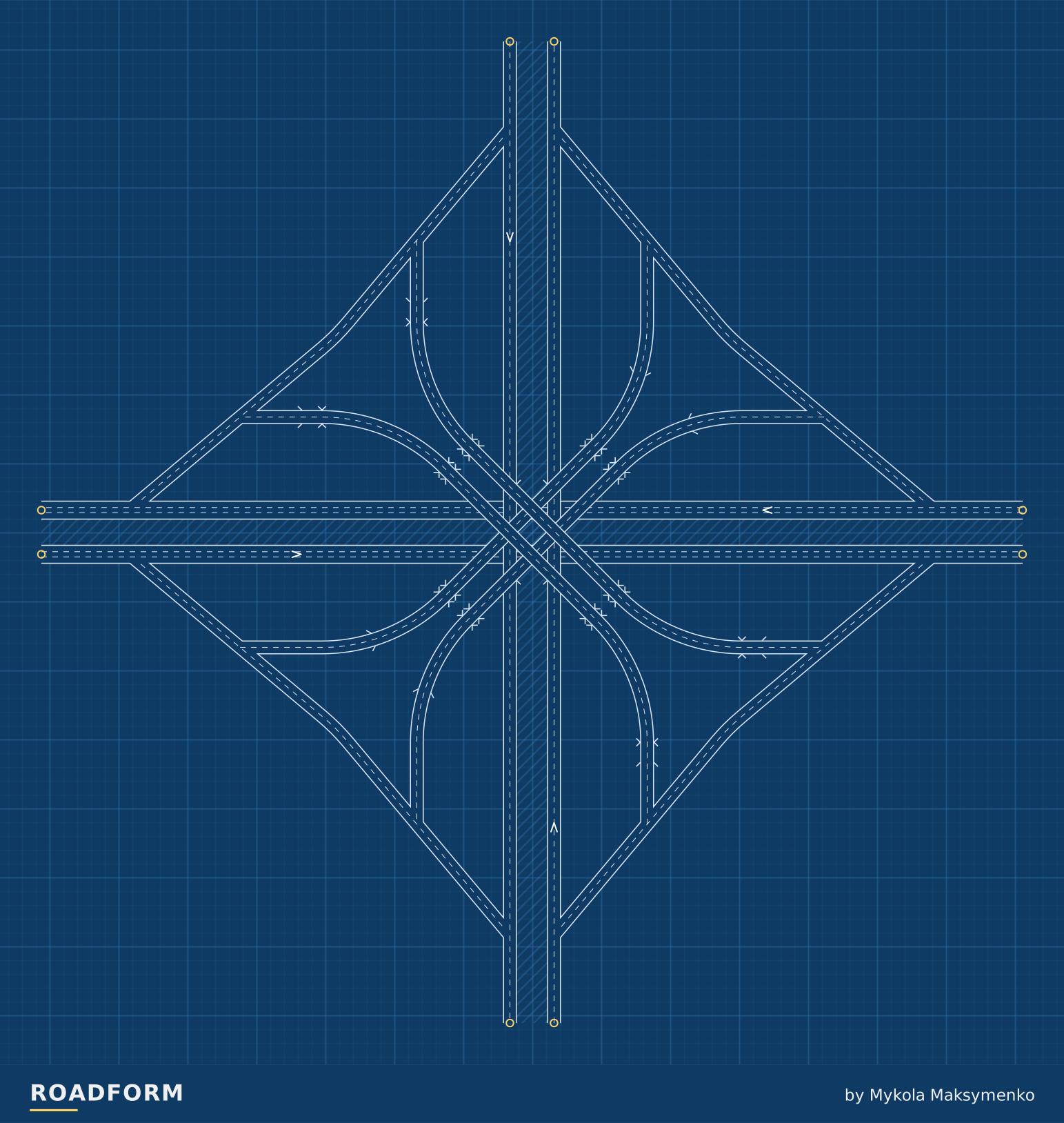
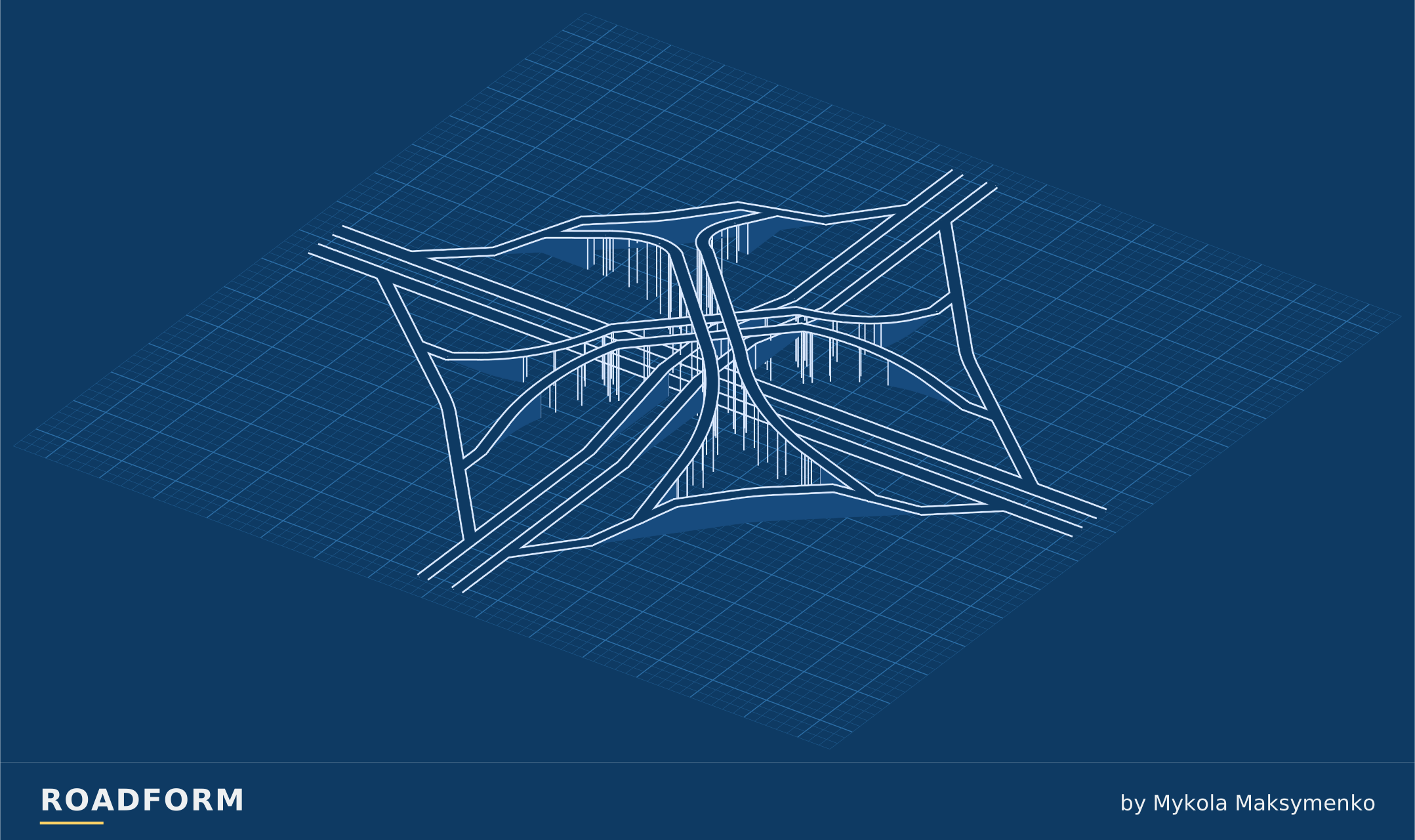
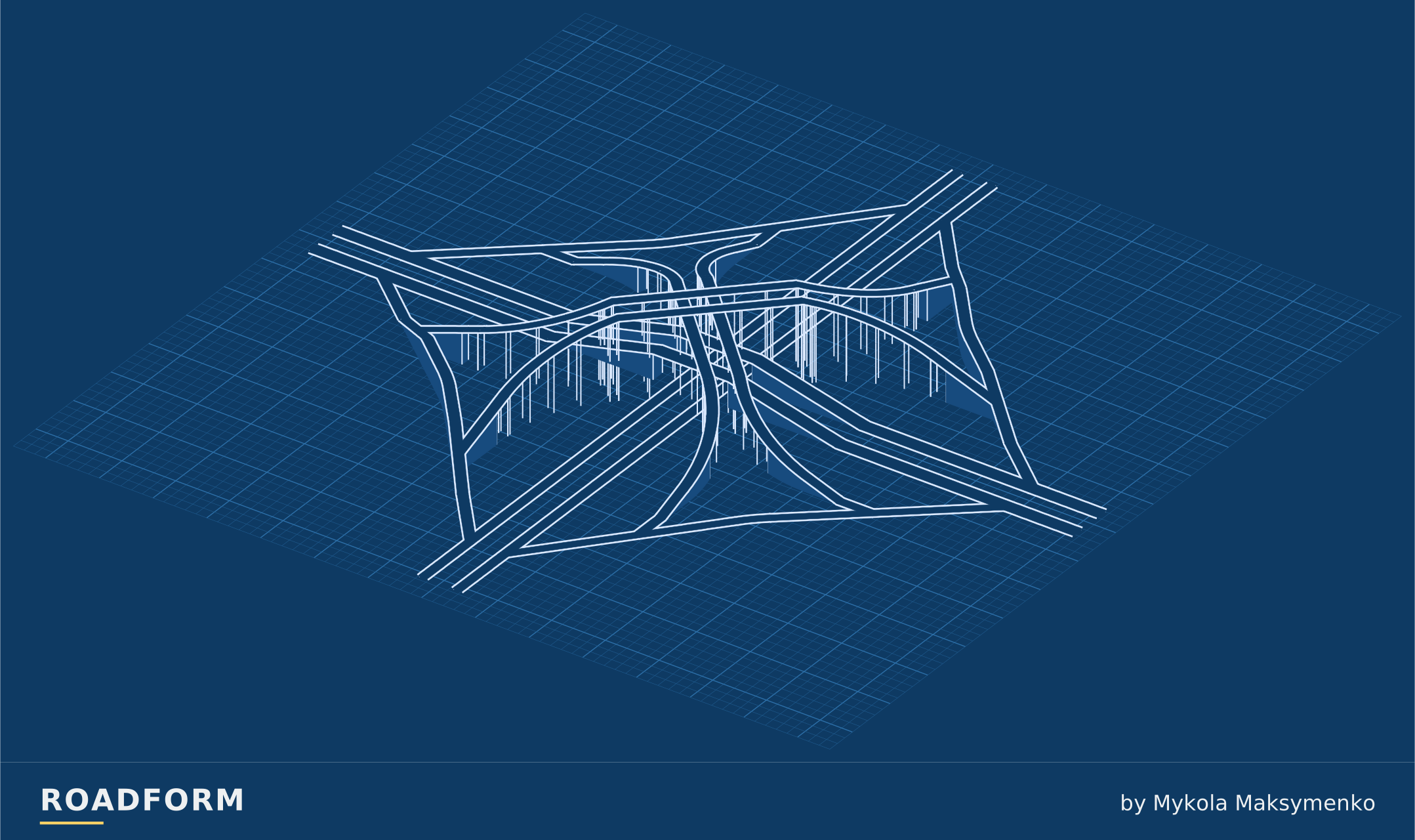
Two highways cross; every left turn flies over the centre on its own ramp, two at 16 m and two at 24 m.
Reading the connections
TF3 · M · On top: Crossing road · Traffic side: Right.
Scale and capacity
Size changes the road widths and the space the layout needs. The guide below uses the default arrangement. The layout reserves room for wider roads.
| Layout | Width × depth | Highest road | Lanes per direction |
|---|---|---|---|
| S | 711 × 711 m | 24 m | Main highway: 2 Crossing highway: 2 Ramps: 1 |
| M | 711 × 711 m | 24 m | Main highway: 3 Crossing highway: 2 Ramps: 2 |
| L | 711 × 711 m | 24 m | Main highway: 3 Crossing highway: 3 Ramps: 2 |
Which road takes the bridge?
Choose which road runs above the crossing. This choice works with every form and size.
TF3 · M · Traffic side: Right. Heights ×3.
Sources and credits
- Roadway Design Manual, 15.3 Types of Interchanges, Texas Department of Transportation. www.txdot.gov
- Evolution of Interchange Design in North America, J. P. Leisch and J. Morrall, Transportation Association of Canada, 2014. www.tac-atc.ca
- Four Level Grade Separation for Los Angeles Parkways Intersection, California Highways and Public Works, May-June 1944, S. V. Cortelyou, California Division of Highways, 1944. libraryarchives.metro.net
- Highway Design Manual, Chapter 500 Traffic Interchanges, 502.3 Freeway-to-Freeway Interchanges, California Department of Transportation, 2023. dot.ca.gov
- Unique Project: Four-Level Grade Separation in Los Angeles First of Kind, California Highways and Public Works, November-December 1948, the editor's note to H. Compagnon's article, California Division of Highways, 1948. libraryarchives.metro.net
- Arroyo Seco Parkway (Pasadena Freeway), HAER No. CA-265: written historical and descriptive data, J. P. Gruen and P. Lee, Historic American Engineering Record, National Park Service, 1999. tile.loc.gov
- Southern Freeways, California Highways and Public Works, January-February 1954, P. O. Harding, California Division of Highways, 1954. libraryarchives.metro.net
- Unsung Heroes: Chief Bridge Engineer Pays Tribute to His Helpers, California Highways and Public Works, January-February 1953, F. W. Panhorst, California Division of Highways, 1953. libraryarchives.metro.net
- Enhancing Safety and Operations at Complex Interchanges With Improved Signing, Markings, and Integrated Geometry (FHWA-HRT-17-048), Appendix A, Federal Highway Administration, 2018. www.fhwa.dot.gov
- Roadway Design Manual, Chapter 10 Interchanges, South Carolina Department of Transportation, 2021. www.scdot.org
- Design Manual M 22-01.23, Chapter 1360 Interchanges, Washington State Department of Transportation, 2024. wsdot.wa.gov
- Indiana Design Manual, Chapter 48 Interchanges, Indiana Department of Transportation, 2013. www.in.gov
- Engineering Policy Guide, 234.3 Directional Interchanges, Missouri Department of Transportation. epg.modot.org
- Hollywood Freeway, California Highways and Public Works, July-August 1950, F. B. Cressy, California Division of Highways, 1950. libraryarchives.metro.net
- Untersuchung des baulichen Aufwandes und der Leistungsfähigkeit von Autobahnknoten (Forschung Straßenbau und Straßenverkehrstechnik 230), abstract, K. H. Trapp; abstract in the Transportation Research Board's TRID database, 1977. trid.trb.org
Real-world photo credits accompany each image. Roadform figures and measurements use Transport Fever 3.