On real roads
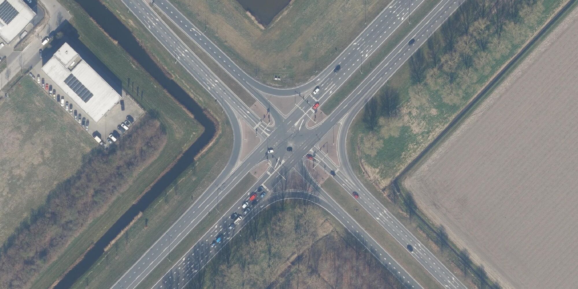
At a channelized junction, islands or markings set the paths that vehicles take, most often for the right turn.1,2 It gets a road of its own: a slip lane, kept apart from the through lanes by an island, ideally raised and normally a triangle, carries the turning traffic to the cross street.2,3,4 There the slip lane may give way, stop, merge or have a signal of its own.3,5 The islands shrink the area where paths conflict, bring merging traffic in at a smaller angle and give people on foot a place to wait.1,2
In the United States, simple devices to channel traffic date back to the early 1920s, but most of the important highway channelization projects were designed after 1940.6 In 1952 the Highway Research Board published 59 examples of channelized intersections, so that engineers could learn from each other's work;6 when it revised the collection in 1962, channelization had become much more widely used.1 By 1985, experience with "over-channelized" intersections had taught engineers that simplicity matters: islands should be kept to the minimum a location needs.7
A slip lane suits a heavy right turn: it raises capacity, saves stops and makes room for large trucks.3,5 Its higher turning speed, an advantage for drivers, raises concerns for people on foot and on bikes.5 Drivers looking for a gap in the cross traffic may miss people on foot coming from the other side, and where the slip lane has no signal, drivers turning at higher speeds may yield to them less.2,5 A 2024 review for Minnesota found crash studies too few to say how slip lanes compare with ordinary right-turn lanes.5 Newer designs bring the slip lane into the cross street at nearly a right angle, so that drivers slow down and see who is crossing.2,5
- Slip lanes
- one for each right turn served: up to four at a crossroads, two at a T
- Island
- normally triangular4
- Island where pedestrians cross (Washington State)
- at least 200 sq ft (about 19 m²)4
- Control where the slip lane ends
- yield, stop, signal, or none5
- Suits
- a heavy right turn delayed by the signal3
- Limit
- faster turns and a harder crossing for pedestrians3
- UK standard (DMRB)
- left-turn slip lane, in left-hand traffic8
Where to see one
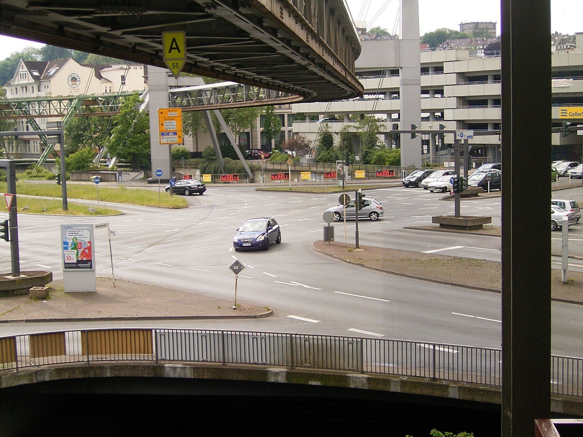
The Alter Markt road junction, a bridge over the Wupper in Wuppertal, May 2008. Frank Vincentz, CC BY-SA 3.0, source, cropped, shown in greyscale Alter Markt, Barmen, Wuppertal, DE. Map
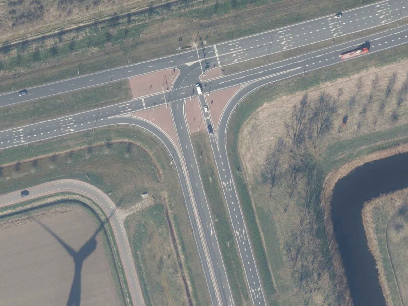
Flevoland, the Netherlands, from the air, 2025: a detail of an orthophoto mosaic of Beeldmateriaal Nederland. Beeldmateriaal.nl, CC BY 4.0, source, cropped, shown in greyscale Gooiseweg N305 at Nijkerkerweg N301, Zeewolde, Flevoland, NL. Map
The Roadform adaptation
In Roadform
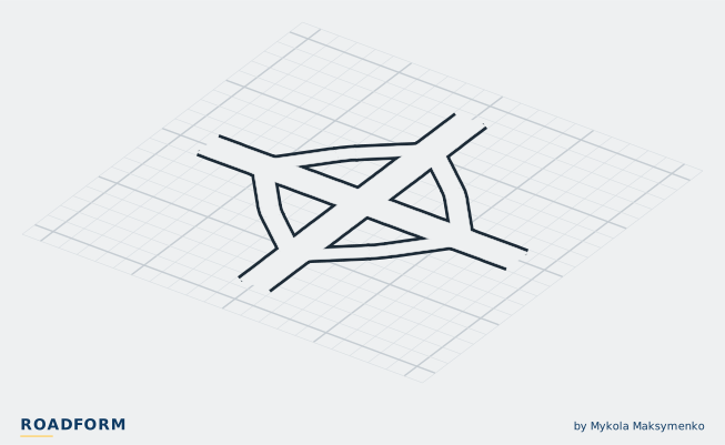
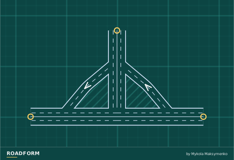
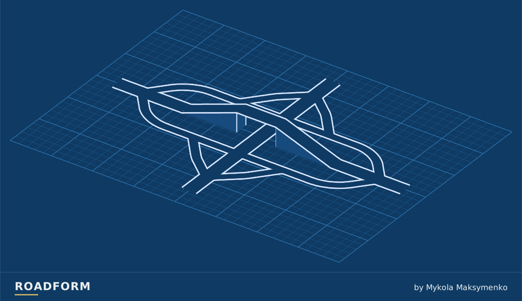
Slip lanes behind triangular islands take kerb-side turns past the junction; 3 or 4 arms.
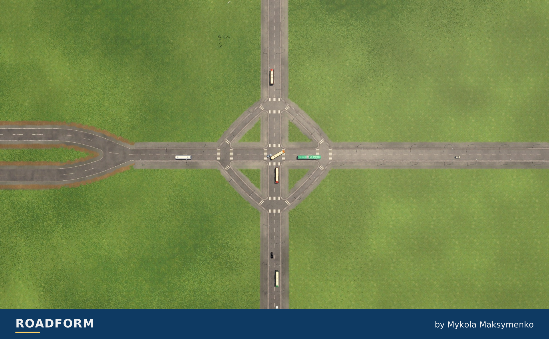
Connections around the junction
Choose the number of connecting arms. The plans hold the other options at their defaults.
TF3 · M · Bridge: None · Traffic side: Right.
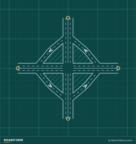
Scale and capacity
Size changes the road widths and the space the layout needs. The guide below uses the default arrangement. The layout reserves room for wider roads.
| Layout | Width × depth | Highest road | Lanes per direction |
|---|---|---|---|
| S | 150 × 150 m | 0 m | Arms: 1 Slip lanes: 1 |
| M | 170 × 170 m | 0 m | Arms: 2 Slip lanes: 2 |
| L | 190 × 190 m | 0 m | Arms: 3 Slip lanes: 3 |
At grade or above
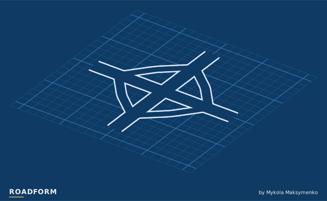
Keep the junction at ground level, or carry the main road across it on a bridge.
TF3 · M · Arms: 4 · Traffic side: Right. Heights ×3.
Sources and credits
- Channelization: The Design of Highway Intersections at Grade (Special Report 74), Highway Research Board, Committee on Channelization, 1962. onlinepubs.trb.org
- Project Development and Design Guide, Chapter 6 Intersections, Massachusetts Department of Transportation. www.mass.gov
- Signalized Intersections Informational Guide, Second Edition (FHWA-SA-13-027), 11.2.1 Channelizing Islands, Federal Highway Administration, 2013. rosap.ntl.bts.gov
- Design Manual M 22-01, Chapter 1310 Intersections, Washington State Department of Transportation, 2024. wsdot.wa.gov
- Pedestrian Safety and Accessibility Best Practices for Channelized Right-Turn Lanes (MN 2024-31), T. J. Gates, J. J. Kay and P. T. Savolainen (Michigan State University) for the Minnesota Department of Transportation, 2024. rosap.ntl.bts.gov
- Channelization: The Design of Highway Intersections at Grade (Special Report 5), Highway Research Board, Committee on Channelization, 1952. onlinepubs.trb.org
- Intersection Channelization Design Guide (NCHRP Report 279), T. R. Neuman (Jack E. Leisch & Associates), Transportation Research Board, 1985. onlinepubs.trb.org
- Design Manual for Roads and Bridges, CD 123 Geometric design of at-grade priority and signal-controlled junctions, National Highways, 2021. www.standardsforhighways.co.uk
Real-world photo credits accompany each image. Roadform figures and measurements use Transport Fever 3.