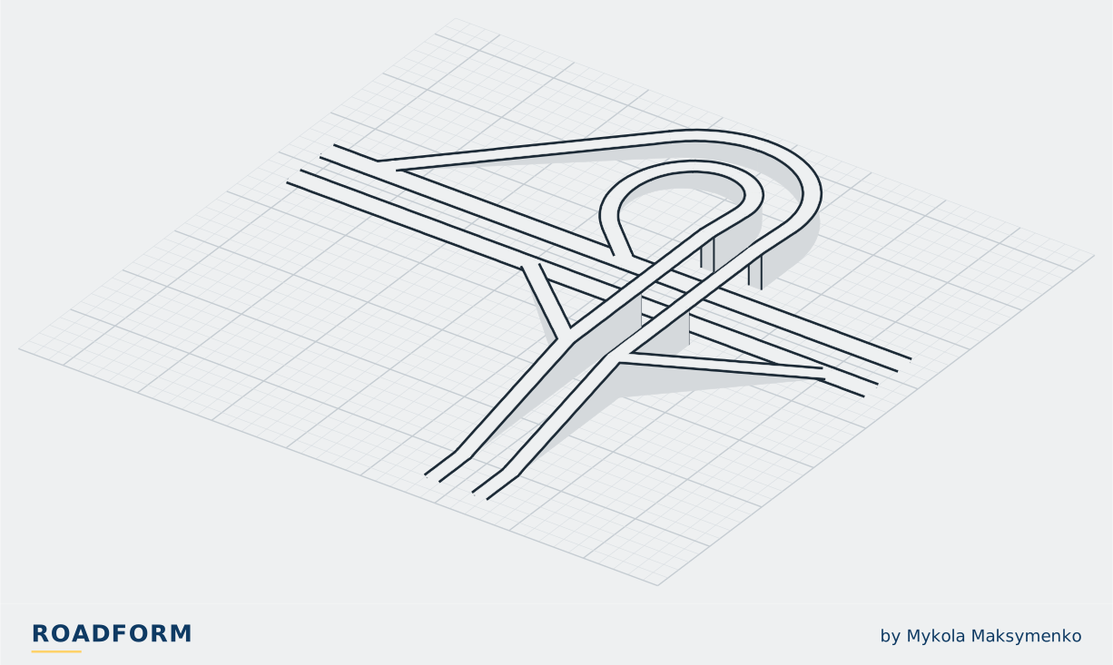
On real roads

A trumpet interchange serves a junction of three legs, such as a road that ends at a freeway.1,2 Two of its four turns run on direct ramps and one on a semi-direct ramp; the fourth, a left turn, goes round a loop inside the semi-direct ramp, and the roads cross on one bridge or a pair of twin bridges.3 It is the most widely used three-leg interchange in the US.3,4
The Pennsylvania Turnpike opened on 1 October 1940,5 and its typical interchange was a trumpet.6 America's major ticket-system toll roads, built between the 1940s and the 1960s, collected the toll at every interchange, and trumpets brought all of an interchange's traffic to a single point, to keep down the plazas and buildings to be built and the cost of handling the cash.6
In 1951 the assistant engineer of design of California's Division of Highways described the trumpet as an interchange used at T intersections.7 Their turning traffic is usually heavier on one side, so the major movement tends to get a direct alignment of a high standard, while the minor one goes round an indirect loop of a lower standard.7
The manuals give the trumpet to a road that ends at a freeway, or to a major highway meeting an arterial or another freeway.2,3,4 They advise against it where the road may later be carried on across, because a fourth leg is usually very difficult to add.1,2,4 Today's manuals give the heavier left turn, in general, to the semi-direct ramp and the lighter one to the loop, which is limited to 800 to 1,200 vehicles an hour, against 1,200 to 1,500 on the semi-direct ramp.1,3 In Nashville, Tennessee's DOT found that the trumpet where I-40 meets Donelson Pike cannot carry the traffic of the road and the airport, and is replacing it with a diverging diamond on a new site.8
- Levels
- 2
- Bridges
- 1, or a pair of twin bridges3
- Loops
- 1, in general for the lighter left turn1
- Loop capacity
- limited to 800 to 1,200 vehicles an hour; a semi-direct ramp 1,200 to 1,5003
- Suits
- a road that ends at a freeway2
- On ticket-system toll roads
- all of the interchange's traffic at one point, for one plaza6
- Limit
- a fourth leg is usually very difficult to add4
Where to see one
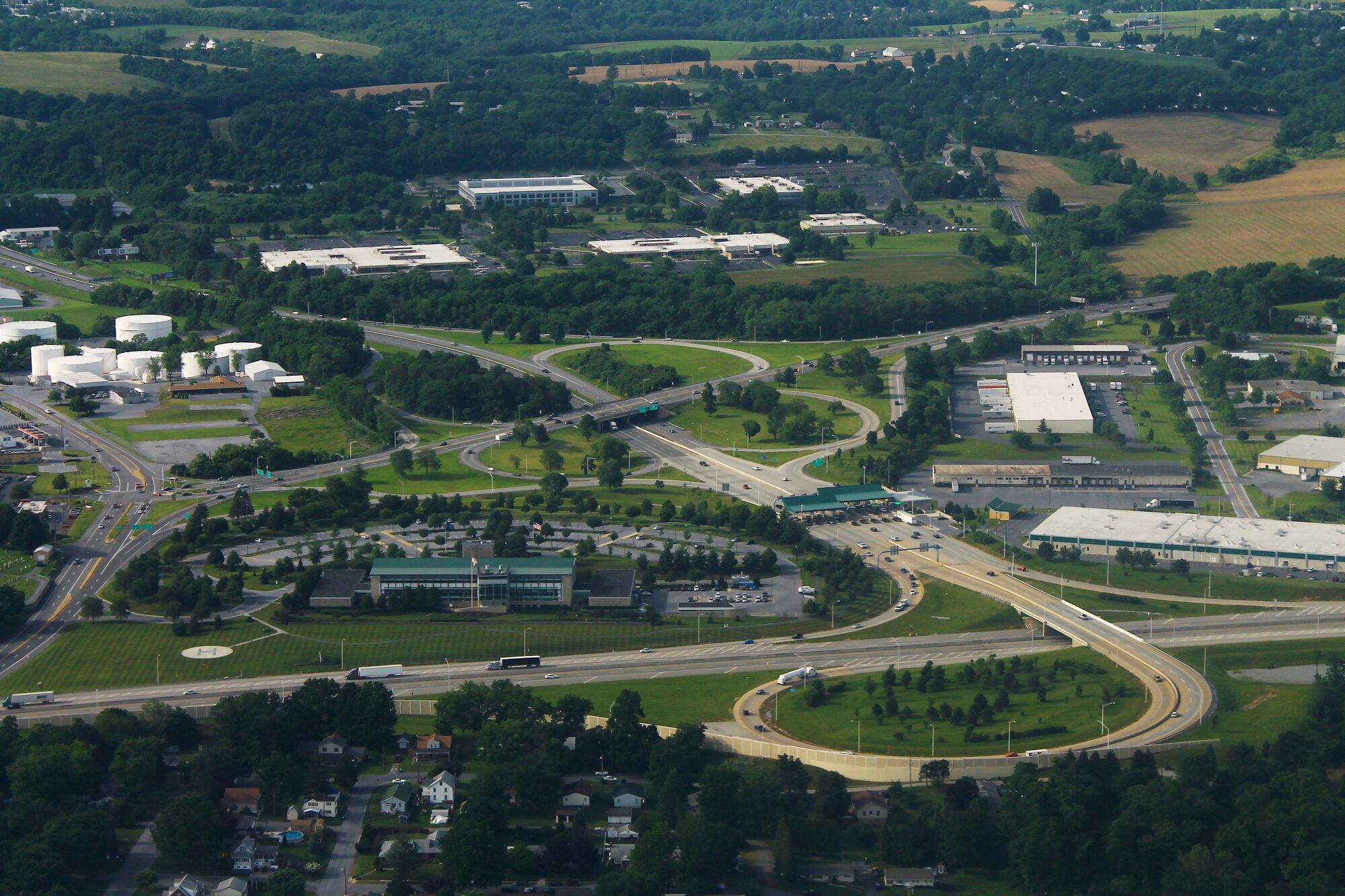
I-283 at PA 283 and the Pennsylvania Turnpike (I-76), Pennsylvania, June 2016. formulanone, CC BY-SA 2.0, source, cropped, shown in greyscale Harrisburg East, exit 247 of the Pennsylvania Turnpike, at I-283, near Harrisburg, Pennsylvania, US. Map
Northeast Extension of the Pennsylvania Turnpike at I-81 and US 6 and 11, north of Scranton, Pennsylvania, US. Map
The Roadform adaptation
In Roadform
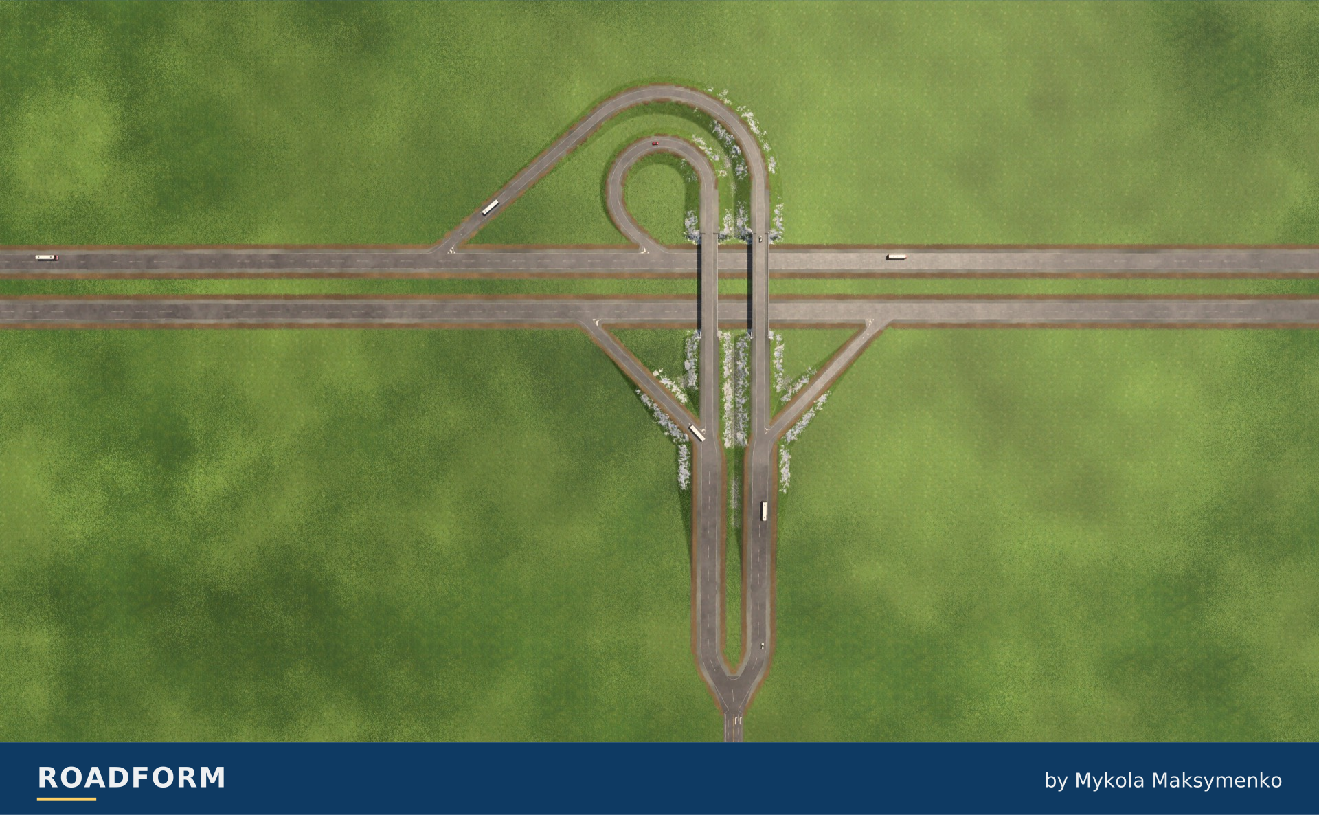
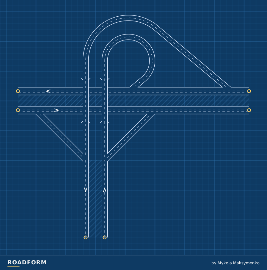
A highway ends at another highway: one bridge, a loop and a flyover ramp round it.
Loop arrangements
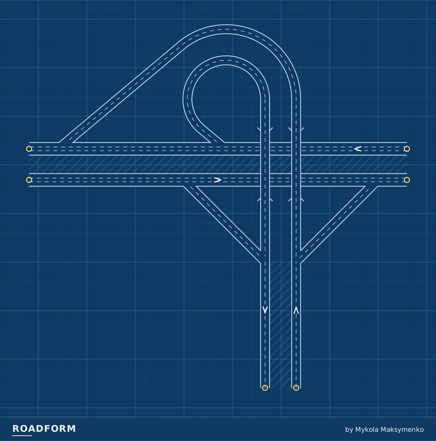
The loop can carry traffic leaving the highway or entering it. Each plan shows one arrangement at the default size.
TF3 · M · On top: Branch · Traffic side: Right.
Scale and capacity
Size changes the road widths and the space the layout needs. The guide below uses the default arrangement. The layout reserves room for wider roads.
| Layout | Width × depth | Highest road | Lanes per direction |
|---|---|---|---|
| S | 354 × 351 m | 8 m | Highway: 2 Ramps: 1 Loops: 1 |
| M | 389 × 369 m | 8 m | Highway: 2 / 3 Ramps: 2 Loops: 2 |
| L | 441 × 396 m | 8 m | Highway: 3 Ramps: 2 Loops: 2 |
Which road takes the bridge?
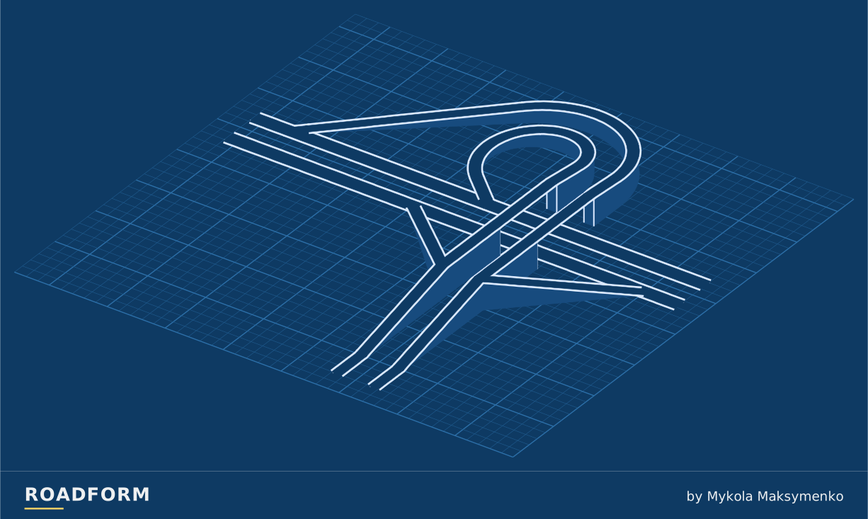
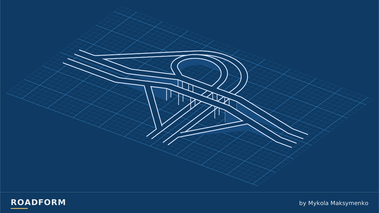
Choose which road runs above the crossing. This choice works with every form and size.
TF3 · M · Exit loop · Traffic side: Right. Heights ×3.

Sources and credits
- Indiana Design Manual, Chapter 48 Interchanges, Indiana Department of Transportation, 2025. www.in.gov
- Highway Design Manual, Chapter 500 Traffic Interchanges, 502.2 Local Street Interchanges, California Department of Transportation, 2023. dot.ca.gov
- Roadway Design Manual, Chapter 10 Interchanges, South Carolina Department of Transportation, 2021. www.scdot.org
- Roadway Design Manual, 15.3.1 Three-Leg Interchanges, Texas Department of Transportation. www.txdot.gov
- PA Turnpike History, Pennsylvania Turnpike Commission. www.paturnpike.com
- State of the Practice and Recommendations on Traffic Control Strategies at Toll Plazas, Federal Highway Administration (prepared by Wilbur Smith Associates), 2006. mutcd.fhwa.dot.gov
- Traffic Interchange Design (California Highways and Public Works, vol. 30, nos. 1-2), S. Helwer, California Division of Highways, 1951. archive.org
- Interstate 40 Interchange at Donelson Pike, Tennessee Department of Transportation. www.tn.gov
Real-world photo credits accompany each image. Roadform figures and measurements use Transport Fever 3.